It's National Water Week and the perfect opportunity to promote one of the most important environmental issues facing our planet. Held annually from 20 - 26 October across Australia, the conservation awareness program aims to cultivate community understanding of water concerns to help conserve Australia's most precious resource. See some of the events in your location.
This year's theme "liveable communities" is timely. Our water resources are under constant threat. From our oceans to rivers and coastal wetlands, human impacts are key contributors to accelerated climate change and the pollution of our aquatic ecosystems. This has the potential to threaten our health, economic stability and community wellbeing.
Understanding the causes of these problems is important if we're to better manage our environment. This makes the work of researchers like those at ANSTO critical. Our scientists, often in research collaborations use nuclear science techniques to help the sustainable management of our reef systems, tracking thousands of years of climate records and helping farmers make better decisions.
To celebrate this important week, we've identified some of our research that's making a positive contribution to sustaining liveable communities.
Read some of the highlights below. Use the links above as a short cut to the research areas.
Australian scientists using brand new techniques to study the Shearwater seabird have made stunning discoveries about the ongoing impact that plastics in the water can have on marine life. Described as ‘sentinels’ by Nobel prize-winner Peter Doherty, birds continually sample oceans and the atmosphere, so their study helps scientists understand environmental changes and dangers.
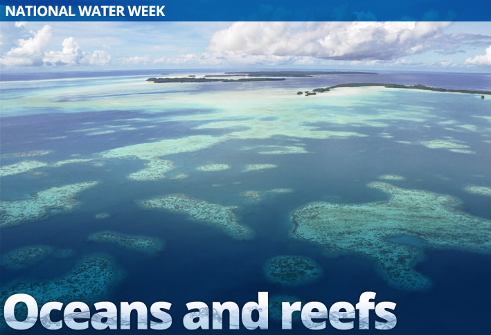
The importance to future reef island resilience: Great Barrier Reef
Coral reef islands are extremely important geomorphological features forming the only habitable land for hundreds of thousands of people, providing refuge for endemic or threatened species of flora and fauna and supporting significant economic services for tourism.
Their preservation is vital, but a number of emerging issues are threatening these ocean communities, including: land submergence, shoreline erosion and salt water intrusion into freshwater supplies. Australian researchers have demonstrated the critical need for further research into this issue following the study of the Great Barrier Reef using a number of nuclear science techniques.
New report shows some coral like it hot
In the central Pacific, scientists have discovered that coral which has survived heat stress in the past is more likely to survive it in the future. With tropical sea temperatures expected to rise by the end of this century it was feared that all corals may be at risk of coral bleaching and death. This study shows that in locations where heat stress is naturally more common, coral reefs may be better able to withstand the expected temperature rises.
Climatic history and sea level fluctuations on Rottnest Island
Scientists have conducted a unique study to reconstruct the climatic history of south-western Western Australia using sediment cores from Barker Swamp, Rottnest Island. Using isotopic techniques, scientists aimed to define the environmental history of the region by studying the Holocene palaeoclimate and sea level fluctuations in the region.
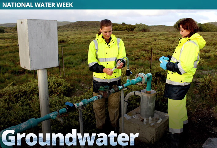
Fresh Groundwater lenses identified within salty groundwater
The Cooper Creek catchment is the longest and most ecologically important dry land river in Australia. Surrounded by geomorphic features such as remnant dunes, mud-capped waterholes there has been uncertainties in recharge and groundwater evolution processes. To understand the regulation of the river system researchers used isotopic techniques which identified a shallow groundwater of low salinity forming freshwater lenses up to 1km wide.
Groundwater age assessment in Gnangara Mound, Western Australia
The Gnangara groundwater system supplies over 70% of Perth’s portable water during periods of drought. It is important to understand how frequently the water is being replenished and how much of the resource is available for use. Isotopic techniques have confirmed groundwater in this basin is between 23,000 to 35,000 years old, in which new water was discovered at 300 meters below the surface.
Rottnest Island’s bore water: a sustainable resource?
ANSTO scientists have commenced a groundwater study on Rottnest Island, WA, to assess the isotopic composition of the water underlying the island. This unique study aims to determine the age of the groundwater as well as the degree of seawater mixing within the aquifer.
Out of this world study of Darling River earns Aussie scientist global attention
Dr Karina Meredith's use of an isotope normally associated with planetary studies to understand the Darling River's complex water systems has earned her recognition at this year's Goldschmidt Meeting, the biggest geochemical conference in the world.
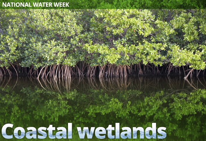
Australian coastline study reveals role of blue carbon in climate change
Blue carbon is a concept name for the capture and storage of atmospheric carbon in the marine environment. Marine and coastal ecosystems play a leading role in the storing carbon to offset greenhouse gas emissions making their preservation vital.
A recent study of Australian estuaries extending across 2000km is aimed at better quantifying the role of the world's coastlines in climate science and has returned some impressive results.
Protecting Australia’s diverse wetlands: Towra Point Reserve
Towra Point Nature Reserve, located in southern Botany Bay, is an internationally significant wetland. The diverse estuarine represents around half of the remaining mangrove area near Sydney and is home to breeding, feeding and roosting sites for many threatened and migratory bird species.
To understand its complex history and ensure its protection, ANSTO has been leading a study to examine the health of this important environmental asset. Results so far indicate that trace pollutant levels are within safe limits for biota in this fragile ecosystem. The results of this work will be presented in November as part of an international Ramsar workshop on Detecting Change in Ecological Character in QueensCliff, Victoria.
How resilient are our shores?
In this thought provoking video taken at the 2013 IAEA Scientific Forum in Vienna, ANSTO's Catherine Chague-Goff discusses the role of nuclear techniques to study storm surges and sea-level rises.
Understanding and managing wetland health
A study of Australia's wetlands by nuclear scientists has revealed native species are under the threat of extinction if water management practices in places like the Murrary-Darling basin are not improved.
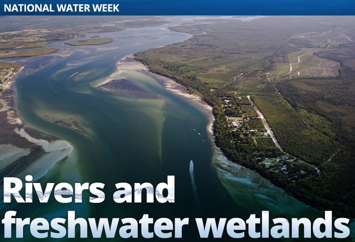
Monitoring evaporation and groundwater inputs to the Darling River during drought
The Darling River faces environmental pressures from both direct human influence and also climate change. Irrigation demands have dramatically altered the riverine ecosystem over the last century, but during drought it is evaporation and saline groundwater input that impacts the water quality of the river through the formation of algal blooms, salinisation and acidification.
Since mid-2002 ANSTO has monitored the changes along the Darling River using stable isotopes and subsequently have modelled evaporative losses and saline groundwater input to the river during the long drought of the last decade.
Understanding food web structures across floodplain wetlands
The Gwydir Wetlands comprise a system of irregularly inundated wetlands associated with the Gwydir River in the North West Slopes region of north-eastern New South Wales, Australia. When flooded they form an important site for breeding waterbirds.
To understand how these food webs that share the same source of water but are often disconnected work, Australian researchers have studied the trophic structure of benthic (food) resources and their consumers.
The prawn whisperer
Prawns might seem like an unusual tool for science, but they’ve played a vital role in understanding the impact of industrial waste emitted from a gold mine into the Strickland River, which is home to a number of tribes and stretches 900 km through the Western Province of Papua New Guinea.
The research was conducted by Aquatic Ecosystems Scientist Tom Cresswell during his PhD conducted with CSIRO Land and Water and RMIT University. Tom is continuing to work with prawns at ANSTO’s Institute for Environmental Research to understand the physiological processes involved in trace metal accumulation.
Using cosmic rays and radionuclides to measure the contribution of the East Antarctic ice sheet
Research documenting the melting ice sheets in East Antarctica since the last ice age (called the Last Glacial Maximum) is providing crucial data for scientists to accurately project sea-level rises by the end of the 21st century. Scientists have used an innovative technique of in situ cosmogenic radionuclide surface exposure dating to determine the geo-chronological constraints on the variability and sensitivity of East Antarctic ice volume.
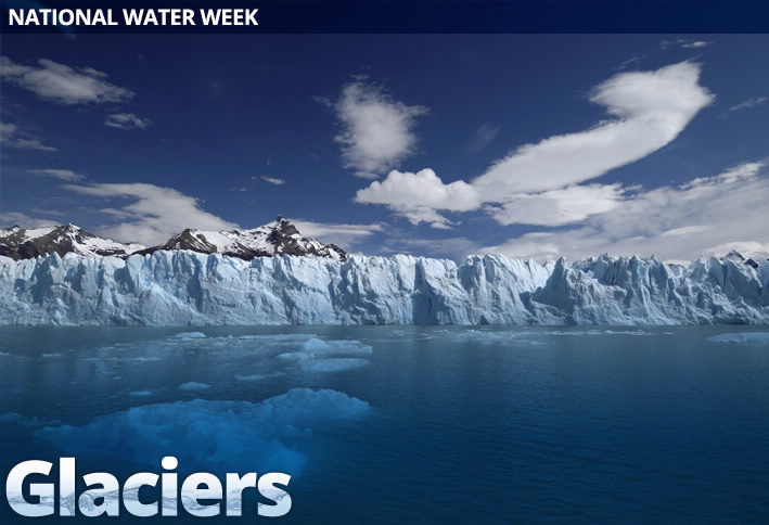
Rocks, Glaciers and climate change- this is Mongolia!
The expansion of mountain glaciers mirror changes in temperature and precipitation as well as leave land formations and sediments which allows scientists to reconstruct past climates. Scientists have used carbon dating and Beryllium-10 techniques in Mongolia to date glacial rocks, which is providing high-resolution records to better understand the variability of our past climate and environment.
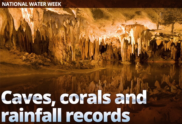
Jenolan Caves
Studying cave environments and their formation provides a unique insight into our prehistoric climate and is an important step towards a quantitative interpretation of palaeo climate. In our field campaign to the Jenolan Caves located 100km west of Sydney in New South Wales, ANSTO and University of Wollongong researchers monitored air gases and drip water through the year, using isotope techniques for our measurements.
A detailed picture of seasonal cave formation (speleothem) emerged, illustrating growth patterns of stalactites and stalagmites, and thus helped to further the interpretation of palaeo-climate records.
Golgotha Caves
On average, there is now 17 per cent less rainfall across Western Australia’s south-western region than was recorded prior to 1970. This rainfall reduction has economic, social and environmental implications for the region.
Ongoing ANSTO research is using stalagmites from Golgotha caves located in the area to help unlock thousands of years of rainfall sensitive data preserved in these structures to help understand what is causing the recent decrease.
A weak El Niño/Southern Oscillation with delayed seasonal growth around 4,300 years ago
Earths interannual climate variability is dominated by El Niño, which is a band of anomalously warm ocean water temperatures that periodically develops off the western coast of South America and can cause climatic changes across the Pacific Ocean. There is a phase of 'El Niño–Southern Oscillation' (ENSO), which refers to variations in the temperature of the surface of the tropical eastern Pacific Ocean (El Niño and La Niña) and in air surface pressure in the tropical western Pacific.
Historical records suggest a lower ENSO variance during the middle Holocene compared with today, however current modelling has not reproduced the full magnitude of the changes. A quantitative study of a Porites coral microatoll located on Christmas Island has shown ENSO variability about 4,300 years ago was persistently reduced by 79 per cent compared with today.
Global company adopts Australian research to clean water worldwide
Ground-breaking water cleansing technology developed by the Australian Government has been commercialised and sold to the private sector.
A field study for calibration of a water quality model for Darwin Harbour
Hydrodynamic and water quality models provide a tool for environmental management and infrastructure planning in the Darwin Harbour, Northern Territory. Darwin Harbour is a tropical estuary which has been subjected to pollutants from sewage outfalls.
ANSTO assisted in this project to help provide a scientific basis for good environmental management of the harbour by using isotope tracer techniques to collect data to validate a computer model of currents and sewage dispersion. This work contributed to the design of the East Point Outfall extension soon to be constructed.