Dr Toshi Fujioka and Dr David Fink from the Institute for Environmental Research ICCAS project, together with Dr Hendrick May, an ARC DECRA Fellow from University of Wollongong, carried out fieldwork in Kakadu and Litchfield National Parks in northern Australia’s Top End last October.
 |
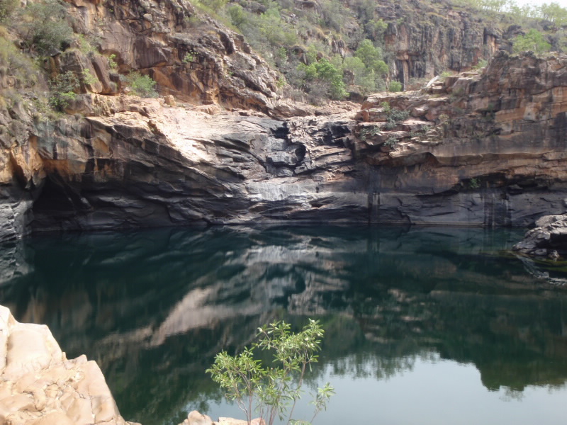
| One of the many waterfalls and associated plunge pools at the Koolpin Gorge. These waterfalls are 20m high and the pools tens of meters in diameter. |
The aim of the project is to investigate over what lengths of time and when in the past did the magnificent rivers in the Top End sculpt the extensive staircase of cascading waterfalls and plunge pools, that are so ubiquitous to northern Australia.
The researchers are experts in using a novel radioisotope dating technique called cosmogenic exposure dating and samples are measured on the world-class ANTARES AMS (accelerator mass spectrometry) accelerator.
The trip is part of Dr May’s DECRA project ‘The wet and dry of tropical Australia: past, present and future’, which examines interaction and response of northern Australian rivers to climate changes over the last hundreds of thousand years. The idea links past variations in monsoon intensity with changes in landscape evolution.
The project is also an extension of Drs Fink and Fujioka’s successful previous study in the Kimberley.
One site, Koolpin Gorge (or "Jarrangbarnmi" as it is called in the local Aboriginal language) is in the upper part of the South Alligator River in the Kakadu National Park, located at the south western edge of the Arhnem Land plateau. The area is a sacred site for the indigenous Aboriginal people of the region.
Prior to any field work being conducted it is mandatory to obtain the correct permits; the researchers also hosted one of the local Aboriginal members to accompany them as a local guide. The late October weather was, as per usual, rather oppressive and they reported that by nine in the morning the air temperature was a balmy 40° to 45 C.
With >80% humidity, field work was physically challenging, -but the waterholes provided much desired relief at the end of the day’s work.
 |
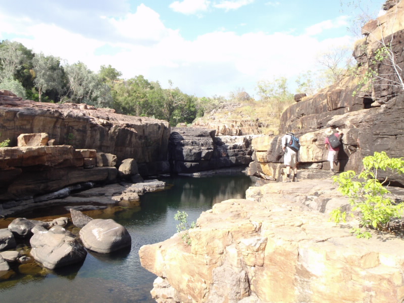
| Sampling involved walking precariously along small blocky ledges that frame the river channel in order to access the many plunge pools. |
The Koolpin Gorge contains a series of cascading waterfalls, which are the result of rivers fed by monsoonal rains plunging over the 200-300 metre high escarpment on their way to the coast. This escarpment divides the hinterland plateau thought to be up to a billion years-old, from the younger coastal lowlands of Darwin and the Ord river system.
“We sampled various rock surfaces exposed above and within the bedrock river channels, such as on the crest of the waterholes, the vertical walls separating the pools and along the river channel between pools,” said Dr Fujioka, adding “we use the AMS ANTARES facility to measure concentrations of rare radionuclides (cosmogenic nuclides, such as beryllium-10, aluminium-26), which are produced by bombardment of cosmic rays which manage to penetrate the Earth’s atmosphere.”
 |
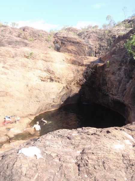
| Cooling off in the refreshing water pool after a hard day sampling bedrock. |
The larger the cosmogenic concentration, the longer the rock surface has been exposed. The exposure ages from the different, but carefully chosen rock surfaces distributed through the river channel and pools, allows researchers to evaluate over what time period and how long since the Top End rivers carved out the waterholes down the escarpment face. This in turn will allow us to estimate the rate at which the escarpment is retreating or breaking down.
The outcome of the project will provide new insights into the pace and scale of long-term landscape evolution of northern Australian and also provide the connection between past rainfall magnitude and the sculpting of the spectacular waterfalls, which are ubiquitous in northern Australia.
Published: 02/04/2014


