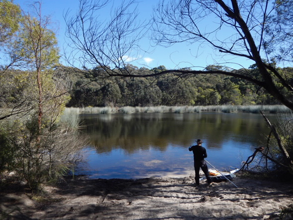
ANSTO environmental researchers have been selected to participate in a three-year project funded by the NSW Office of Heritage and Environment to further investigate the movement of water at Thirlmere Lakes.
The five lakes, which are located in the Blue Mountains World Heritage Area have experienced a recent decline in water levels that exceeds historical fluctuations.
“It is our intention to find out if the changes are climate-driven or other factors are contributing to the decrease in water,” said ANSTO senior principal research scientist Dr Dioni Cendón, who will act as Chief Scientist for project.
ANSTO will acquire and interpret environmental isotope data to provide fundamental hydrogeological information to the NSW Office of Environment and Heritage.
An understanding of hydrological dynamics can guide the formulation of best management practices for the lakes.
“As previous work did not include strong evidence of hydraulic connections, pathways and processes of water loss from the Thirlmere Lakes system, this is an area where we can be very helpful,” said Cendón.
The levels of water in the lakes are lower than during periods when severe drought occurred in Australia, including early in the 20th century.
“If the droughts at the turn of the century and the 1940s were more severe than the current drought, and the lakes managed to keep some water in them then, why is it that the lakes now dry out completely? Our study aims to answer that question,” asked Dr Mark Peterson, who will lead to day to day activities for the project.
Isotopic environmental tracers can provide crucial information about water balance and mixing processes that contribute to the sources of water and loss mechanisms.
Cendón said that as seasonal variability and rainfall events may substantially affect water characteristics, a multi-year time series was essential to make a correct interpretation of water dynamics.
Sampling of lake, groundwater and rainfall for isotopic analysis, which is combined with chemical and physical measurements, will be carried out over three years at existing and new sampling points.
As possible lake water sources include rainfall, surface runoff soil water and shallow groundwater, ANSTO researchers will use stable naturally-occurring water isotopes as well as marine aerosol concentrations to determine the origin of the water and quantify evaporation.
Naturally-occurring isotopes which originate or accumulate in the ground can also be useful in characterising different sources of water and mixing.
An extensive suite of environmental tracers can be used to determine the age of groundwater, residence time, water budget, and identify pathways and rates of flow.
ANSTO has a wealth of experience with corrections and interpretations relating to the Sydney Basin water cycle, including leading all prior studies of the isotopic composition of rainwater in the basin.
“Members of our project team, which includes Dr Mark Peterson, Dr Cath Hughes, Dr Karina Meredith, Chris Dimovski and Stuart Hankin, are experts in the use and sampling of naturally-occurring environmental isotopes.
Each has more than a decade of experience analysing, interpreting and collecting naturally-occurring radioisotopes in the Sydney Basin’s Hawkesbury Sandstone, which dominates the Thirlmere Lakes area.”
“We also have experience in determining the possible impacts of groundwater extraction from bores and mines,” said Cendón.
The Tahmoor Colliery, which is located in close proximity to the Thirlmere Lakes, extracts groundwater for mine operations.
Independent isotopic and hydro-geochemical data can be used to inform, constrain, test and calibrate other models.
A number of other researchers from the University of NSW Connected Waters initiative, University of Wollongong, will be collaborating on the project and providing data on geology, geomorphology, and hydrogeology.
“You need to integrate the isotopic data with the geological/geochemical data to inform the findings and identify trends,” said Cendón.
“Lake sediments provide a chronological climate record that goes back thousands of years. The University of Wollongong will be doing this analysis.”
The project commenced in May with ongoing sampling of lake water and from existing groundwater bores.
“The sampling of lake water gives a water budget and determine if the evaporation we see in our stable naturally-occurring isotopes coincide with the amount of water that is there. This also indicates how dependent the lakes and local ecosystem are on groundwater, rather than merely recent rainfall.
Groundwater sampling allows us to establish links between the surface and the deeper groundwater if they are present.
Thirlmere Lakes seem to be quite unique in terms of where they sit in the landscape. It is very important to resolve what is causing the fluctuations for future resource management and preservation of the local ecosystem” said Cendón.
Published: 28/12/2017


